Winds and heavy rain in south-west England as schools shut

Steven Morris
Winds of almost 80mph and very heavy rain have battered parts of south-west England as Storm Ciarán brings disruption to swathes of the UK.
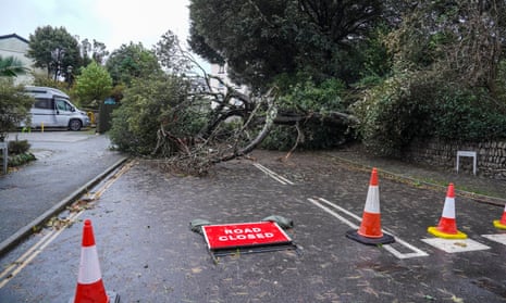
Hundreds of schools have been shut, roads closed, flights and bus and rail routes disrupted with “danger to life” amber warnings in place for wind across southern England.
By 7.30am on Thursday the Environment Agency had issued 65 flood warnings for England and 156 flood alerts. Natural Resources Wales warned river levels in the far south-west of the country could be the highest ever recorded. Around 10,000 homes were without power in south-west England.
The Channel Islands bore the brunt of the storm on Wednesday night and into the early hours of Thursday, where Jersey police said winds reached 102mph (164km/h).
About 40 people were evacuated from their homes on the island because of damage to buildings. Four people were taken to A&E and the roof of Jersey general hospital was damaged.
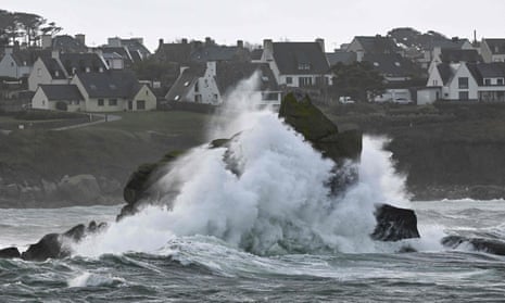
Very large hailstones pounded the islands and there were 9-metre swells and an unconfirmed report of a tornado. The Jersey Met Section issued a red wind warning, its highest level. All flights from Jersey, Guernsey and Alderney airports on Thursday were cancelled and ferries to and from the islands suspended.
Wind speeds of more than 70mph were recorded on the Isles of Scilly and at Berry Head in south-west England while there were winds of more than 60mph at some areas of the south and south-east.
Key events
France’s transport minister Clément Beaune has expressed condolences to the family and colleagues of the truck driver killed as a result of storm Ciarán.
Mes pensées vont à la famille et aux collègues du chauffeur routier victime de la tempête #Ciaran et décédé cette nuit dans l’Aisne.
J’ai exprimé mes condoléances à la famille du transport routier.
Les services de l’Etat restent pleinement mobilisés : vigilance et protection.
— Clement Beaune (@CBeaune) November 2, 2023
Dutch headwind cycling event cancelled
Senay Boztas
A national headwind cycling event in the Netherlands has been called off as storm Ciarán batters the coast.
Despite founder Robrecht Stoekenbroek telling media on Wednesday that people were “desperately enthusiastic” for the eighth race – which can only happen in high winds – conditions were too much even for Dutch cyclists.
The Eneco NK Tegenwindfiesten, ‘cycling against the wind’, is carried out on bicycles with a back brake and no gears against windspeeds of seven or more on the Beaufort Wind Scale – a “near gale”. It started this morning, with contenders set to plough eight and a half kilometres over the Oosterscheldekering Eastern Scheldt Storm Surge Barrier, part of the Delta Works that protect the Netherlands from North Sea floods in Zeeland. But by 1pm the race was cancelled “with pain in our hearts”.
Amber alerts were issued, schoolchildren sent home early, and traffic organisation ANWB advised working home because trees in leaf were more likely to blow over.
NOS broadcaster reported one person has been hit by a fallen tree in The Hague and another two wounded in their car on a motorway in South Limburg.
Reader weighs in
Carolyn, a reader on the Kent coast near Deal, sent us a photo, writing:
The worst seems to have passed, only damage my trellis and vine! Many uprooted trees in the area blocking roads, some of which have now been moved as the wind is dying down.


Damien Gayle
The port of Dover was briefly closed this morning, and ferries across the Channel to Calais cancelled, as Storm Ciarán blew gusts of more than 70mph off the coast of Kent.
“Due to adverse weather from Storm Ciarán, all sailings are currently suspended from the Port of Dover,” the port authorities posted on Twitter/X at 7.59am. At 11.27am, they posted again to say it had reopened to shipping.
Despite that, one response to the post said police were still blocking roads into the port.
Gusts of 71mph were reported in Langdon Bay near Dover, according to the BBC. The Met Office has issued yellow warnings for wind and rain in the area for most of Thursday.

The French national meteorological service continues to warn of strong winds, noting that winds are moving toward the north throughout the day.
More photos from around Europe as storm Ciarán hits.
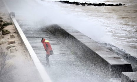
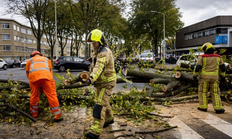
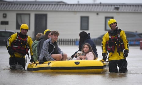
An update from the UK Met Office.
Water supplies cut in parts of south east England

Damien Gayle
Water supplies have been cut in a number of areas in south-east England after Storm Ciarán affected power supplies, the regional water company has said.
South East Water said it was liaising with power distribution networks to restore power to pumps. “As soon as we’re alerted to a supply issue we are responding as quickly as possible to get taps flowing again,” South East Water said in a service update on Thursday morning.
“Our key sites continue to operate on generators to ensure we can keep treating and pumping water to the majority of properties, maintaining supplies to as many as possible in the event of a power cut.”
How is the storm affecting you and your community?
We want to hear from you.
France sees record winds, lorry driver killed

Angelique Chrisafis
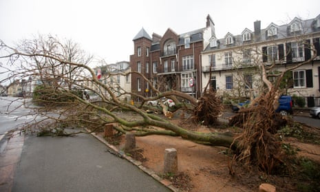
North-western France experienced record winds of up to 200km/h (124mph), as a lorry-driver was killed and six more people were injured, while more than 1.2 million people lost electricity and tens of thousands lost their phone signal.
More than 1,315 people were moved from campsites and shelters to safer accommodation.
The government announced that a lorry driver was killed in the Aisne district in northern France, after a tree fell on the cabin of his heavy-goods lorry before dawn on Thursday morning.
The transport minister Clément Beaune said the driver’s death underlined how even in areas that were not on red alert, there could be very high risks and high danger on roads.
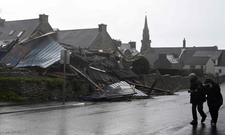
Many roads were closed to cars, for example in Finistère in Brittany where the many obstacles littering roads, meant authorities closed large areas of the road network. Residents were told to stay home and not approach the coast.
Four other people were injured, including three fire-officers, often in relation to falling trees. Two fire officers were injured on a road north of Rennes because of a falling tree, a motorcyclist was injured in a collision near Nantes due to an uprooted tree.
Electricity was down in over 1 million homes mostly in Brittany, but also in Normandy, after trees fell on electricity lines and pylons were blown over by winds.
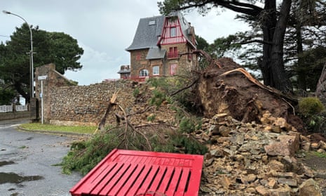
Storm Ciarán has caused flooding, travel disruptions and school closures.
Watch footage of the storm’s impact.
Dramatic accounts from UK

Steven Morris
The worst of the wind seems to have passed through the south-west of England and the Channel Islands but dramatic accounts are coming in.
Suzie Phillips, 44, a civil servant in Jersey, told the PA news agency said she was awoken by huge hailstones. “The hailstones were heavier and bigger than a golf ball and we’ve had three windows damaged by them – in my daughter’s bedroom, a landing and a bathroom. It was quite worrying, especially for the kids – they were quite anxious about it.”
The storm cut off the island of Portland in Dorset on the south coast, which is connected to the mainland by a narrow causeway with the flood siren alert activated for only the second time in nine years.
Heather Jones, of the Stand up to Racism group, who are in contact with asylum seekers on the Bibby Stockholm barge, which is berthed in Portland port, said: “Some people on board are getting quite seasick. They have told me they got absolutely no sleep last night and the boat was shaking so much it was pretty scary.”
A young cyclist and a walker were knocked over by waves nearby at West Bay.
Residents in the village of Loders, just inland, said a “mini-tornado” passed through.
Bridport fire station posted on Facebook: “Mobilised to alarms actuating in Loders. On arrival we were met by damage to multiple properties and large amounts of debris strewn across the road after what was described by residents as a mini tornado had passed through the village.
“One building had taken the full force and caused substantial damage to the thatched roof and gable end of the property. Large trees had been uprooted too. Other properties received damage of various forms.”
Speaking of the storm, Gerry Murphy, a senior forecaster at Met Éireann, told RTÉ’s Morning Ireland that “we were lucky in the sense that it maintained its track well to the south of Ireland.”
The yellow level warnings were issued because there was always the threat of flooding in areas that have already flooding, so these amounts may have had an impact with regard to flooding but overall the rainfall amounts were not exceptional in any way.
Scientists caution that climate change may allow Storm Ciarán to drop more water on Europe

Ajit Niranjan
Climate change may be allowing Storm Ciarán to drop more water on western Europe, scientists have warned.
“There are a lot of attribution studies and other lines of evidence showing that autumn/winter storms like this are more damaging because of climate change,” said Friederike Otto, a climate scientist at Imperial College London and co-founder of the World Weather Attribution network of researchers.
“That’s because the rainfall associated with these types of storms is more severe due to climate change, and the storm surges are higher and thus more damaging due to the higher sea levels.”
For every degree the planet warms, the air can hold about 7% more water vapour. Humanity has heated the planet 1.2C since the Industrial Revolution by burning fossil fuels, farming livestock and destroying nature – all of which pump heat-trapping gas into the air.
“The link between strong winds and climate change is much less clear,” said Michael Byrne, a climate scientist at the University of St Andrews. “There is some evidence suggesting storms like Ciarán will become windier as the climate warms, but the jury is out.”
Scientists will have to formally study the storm to work out if climate change made it worse. In some cases, their attribution studies have found no significant link.
But as the planet heats up, scientists expect extreme rainfall to get stronger across most of Europe.
Melissa Lazenby, a climate scientist at the University of Sussex, said climate models agree that storms like Ciarán will become more common.
“It is also very likely that the intensity of these winter storms will increase, and that rainfall from these events will result in larger impacts such as flooding and larger storm surges alongside the coastal regions.”
The European Organisation for the Exploitation of Meteorological Satellites has shared an image of the storm from space.
The Royal Netherlands Meteorological Institute (KNMI) has also warned of strong winds. Here is a map.
The impact of Storm Ciarán can be felt across several European countries this morning. Here are some photos.
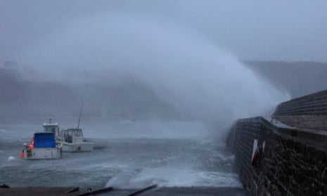
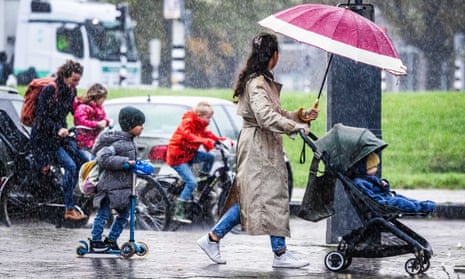
Here is a warning map issued by Spain’s state meteorological agency this morning.
⚠️ Este es el mapa de avisos en vigor para hoy, 2 de noviembre, actualizado a las 10:00 horas.
👉 Peligro extremo en el Atlántico gallego y Cantábrico oriental por olas de 8 a 9 metros.
👉 Peligro importante por vientos muy fuertes en amplias zonas de la Península y Baleares. pic.twitter.com/y9vkVbGdTu— AEMET (@AEMET_Esp) November 2, 2023
The UK Met Office said its warning is “now more focused for where the strongest winds associated with Storm Ciarán will be in the south-east.”


