

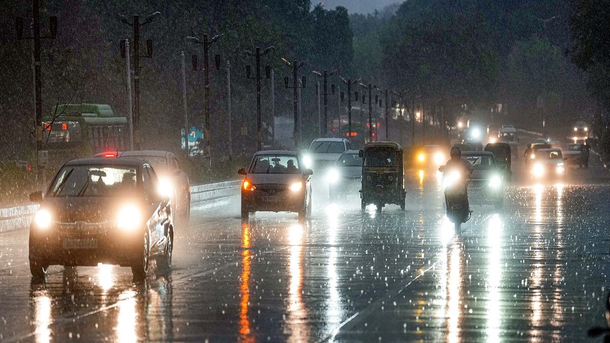
It does not feel anything like May. Just when north India was bracing for one of the hottest months of the year, it was greeted with widespread rains and hailstorms. Delhi recorded its coldest night of May in almost 40 years, with the minimum temperature dropping to 15.8℃ on Wednesday night.
The last it happened was on the night of May 2, 1982, when the mercury plummeted to 15.2℃ — the lowest ever in the month. It’s not just the national capital but the entire northwest India known for its searing summer has been wrapped in surprisingly cool weather. White clouds float lazily across the blue skies, and day temperatures remain below 37℃ — 3-7℃ below normal for this time of the year.
“It is not entirely unusual, but not very common either. Such weather changes do happen once in many years. There was an active western mid-latitude weather system, which was very intense and its impact was seen across the plains. The continuous rains have brought the mercury down significantly,” senior India Meteorological Department scientist Rajendra Kumar tells News18.
The weather observatory in Delhi Ridge recorded the lowest minimum temperature of the plains at 14.2℃ on Wednesday.
WHAT LED TO THE SUDDEN CHANGE?
An intense Western Disturbance hit the Himalayan region around April 26. These are the rainy systems that originate in the Mediterranean Sea and travel eastwards to bring rain/snow over India. Such was the strength of the system that it not only brought torrential rains to the hilly areas but even the plains for almost a week.
Delhi’s Pitampura observatory recorded close to 53 mm of rain in the last four days, including 32.8 mm of rainfall on Wednesday.
EL NINO EFFECT?
According to some scientists, such anomalous weather can be expected during the El Nino years – when the equatorial Pacific Ocean becomes warmer than usual.
“El Nino year generally brings a large natural variability in the pre-monsoon rains during April and May. The WDs tend to go deeper and impact a large part of the plains, which we just witnessed. This year, we have been getting a lot of disturbances, and most of them have been intense,” says Dr M Rajeevan, former Ministry of Earth Sciences (MoES) secretary. “But these are year-to-year variations. We should be concerned, if we see a long-term trend.”
The cool weather has provided much-needed relief from the scorching heat, with IMD ruling out any possibility of heatwaves at least for the next five days. Quite a contrast from 2022, when north India bore the brunt of the hottest summer in 100 years.
CHANGING WEATHER PATTERNS?
There is certainly a sense of relief, but such sudden changes in weather are being studied by scientists for an underlying impact of changing climate patterns. There is no clear long-term trend, it seems, but there are inter-annual variations.
Weather disturbances which normally impact the northern region during the January-March period are now quite active even during April and May when their activity usually abates.
“There have been continuous spells of rain. It was not so intense before; except for 2021 and 2023, the rainfall has been normal to below normal in April in Himachal Pradesh over the last 20 years. This year, it was in excess, and continues even now,” says Surender Paul, senior IMD scientist from Shimla.
If the latest forecast is to be believed, the weather is likely to remain pleasant for another few days, before the “summer-like” conditions finally return, but no heatwaves at least for the next five days.
The rainfall has reduced significantly over the region but is likely to pick up again Friday night onwards. A fresh Western Disturbance could hit the Himalayan region on Friday night and bring fairly widespread rainfall/snowfall over the mountainous states.
Northwestern states like Punjab, Haryana, and Delhi could also witness scattered rainfall with thunderstorms/lightning/gusty winds over May 6-7. There is also a possibility of hailstorms this Sunday in a few places.
Maximum temperatures would then increase and become near normal over the country on May 7, except coastal Odisha and coastal West Bengal, where these are likely to be above normal by 2-4°C by May 8, said IMD.
Read all the Latest India News and Karnataka Elections 2023 updates here